Kamalpur Roran Site
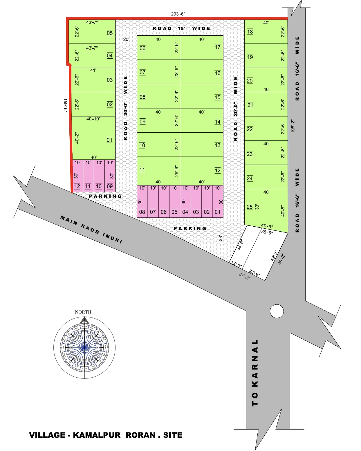
A completed MBI mixed-layout development covering 38,989 sq ft, combining 12 shop units and 25 residential plots with a structured road-and-parking network and direct road context toward Indri and Karnal as shown in the supplied plan.
View Site Plan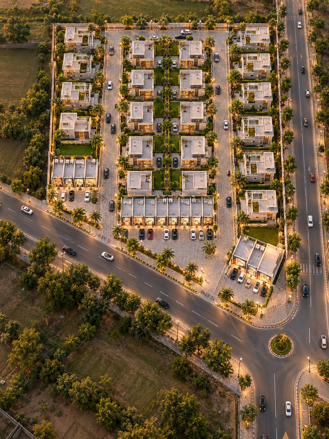 12 SHOPS • 25 PLOTS
Planning Highlights
- 12 Shops Twelve numbered shop units are shown along two prominent frontage groups.
- 25 Residential Plots Twenty-five residential plots are arranged across three main development blocks.
- 11,051 sq ft Road & Parking The source area chart collectively allocates 11,051 sq ft to internal road and parking space.
A Compact Mixed Layout of Shops, Residential Plots and Defined Road Access
Kamalpur Roran Site is presented in the supplied project plan as a completed MBI mixed-layout development with a total project area of 38,989 sq ft. The area chart records 12 shop units and 25 residential plots.
The project allocates 3,595 sq ft to shops, 24,343 sq ft to residential plots and 11,051 sq ft collectively to roads and parking. The drawing organises these units across three residential blocks with shop frontage positioned toward the lower road and parking areas.
The supplied plan also identifies a hierarchy of 15-ft, 20-ft and 16-ft-6-in road sections, along with direct road context through Main Road Indri and a connecting direction toward Karnal.
Understand the Layout Clearly
Explore the supplied Kamalpur Roran project plan showing the shop frontage, 25 residential plots, internal road hierarchy, parking areas and documented project area distribution.
Recorded Area Distribution
Official values transcribed directly from the drawing's area chart (Reconciled Sum: 38,989 sq ft):
| Source Category | Recorded Metric |
|---|---|
| Total Project Area | 38,989 sq ft |
| Shop Area | 3,595 sq ft |
| Residential Plot Area | 24,343 sq ft |
| Road & Parking Area | 11,051 sq ft |
| Total Shops | 12 Units |
| Residential Plots | 25 Plots |
Shop and Residential Plot Layout
The supplied layout contains 12 numbered shops and 25 residential plots. The regular shop rows repeatedly show 10-ft frontages and 30-ft depths, while the residential blocks contain a mixture of regular 40-ft-wide modules and varying or irregular end plots:
Road Access and Parking Within the Layout
The supplied layout allocates 11,051 sq ft collectively to roads and parking, with a structured network of 15-ft, 20-ft and 16-ft-6-in roads, dedicated frontage parking, and direct access onto Main Road Indri:
11,051 sq ft Area
Substantial area allocated collectively in the source area chart for internal access roadways and vehicle parking.
15–20 ft Roads
Internal circulation network with 20-ft-wide north-south corridors and a 15-ft-wide connecting northern thoroughfare.
16 ft 6 in Road
External/site-edge road labelled “ROAD 16'-6" WIDE” coordinating lateral vehicular approach along the eastern perimeter.
Frontage Parking
Dedicated parking areas designated directly in front of both commercial shop blocks (01–08 and 09–12).
Site Planning Visible in the Layout
The supplied Kamalpur Roran plan primarily documents property organisation, roads, parking and external-road access. It does not include a separate utilities or amenities schedule, so only elements clearly visible in the plan are presented:
Layout & Property Demarcation
- Defined residential plotted blocks (01–05, 06–17, 18–25) organised systematically.
- Dual commercial shop frontage groups (01–08 and 09–12) facing the primary thoroughfare.
- Precise north-orientation compass explicitly embedded in the technical drawing.
Circulation & Parking Network
- 11,051 sq ft combined area allocated collectively to road and parking infrastructure.
- Internal circulation structured across 15-ft, 20-ft and 16-ft-6-in road corridors.
- Dedicated parking zones positioned directly in front of the shop blocks.
- Road-junction arrangement illustrated near the southern connectivity corridor.
* The items above reflect site-planning features visibly designated on the supplied layout drawing. Operational status and specific civic utility provisions are subject to independent verification.
Village Kamalpur Roran with Road Context Toward Indri and Karnal
The supplied project plan identifies the development as “Village - Kamalpur Roran . Site”. The drawing also shows frontage and arterial access through Main Road Indri and a connecting road direction heading To Karnal.
Note: Road directions reflect alignment text recorded on the technical drawing. Exact postal coordinates, driving times, and Google Maps links should be verified independently prior to site visits.
View Project Information
Looking for Information About Kamalpur Roran Site?
This development is presented as part of MBI's completed project portfolio. If you require project-related information or technical layout clarifications, submit an enquiry and select Kamalpur Roran Site so your request can be reviewed in the correct project context.
Current resale or other availability, if any, is subject to independent property ownership and formal verification.