Durga Colony
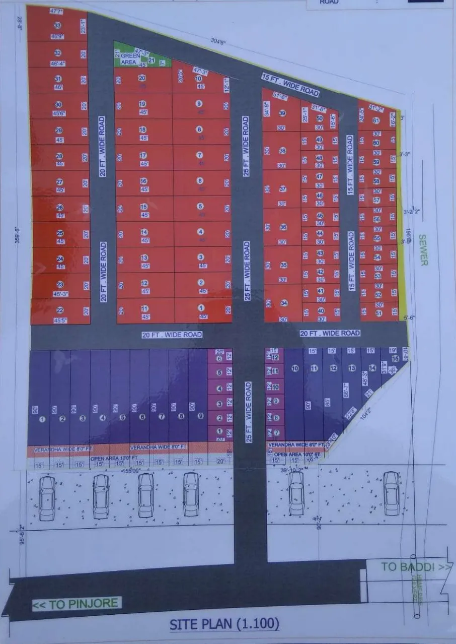
A completed MBI development at Village Sito Majra, Kalka, documented through a detailed subdivision plan showing proposed and existing building blocks, internal roads, green/open areas and access toward Pinjore and Baddi.
View Site Plan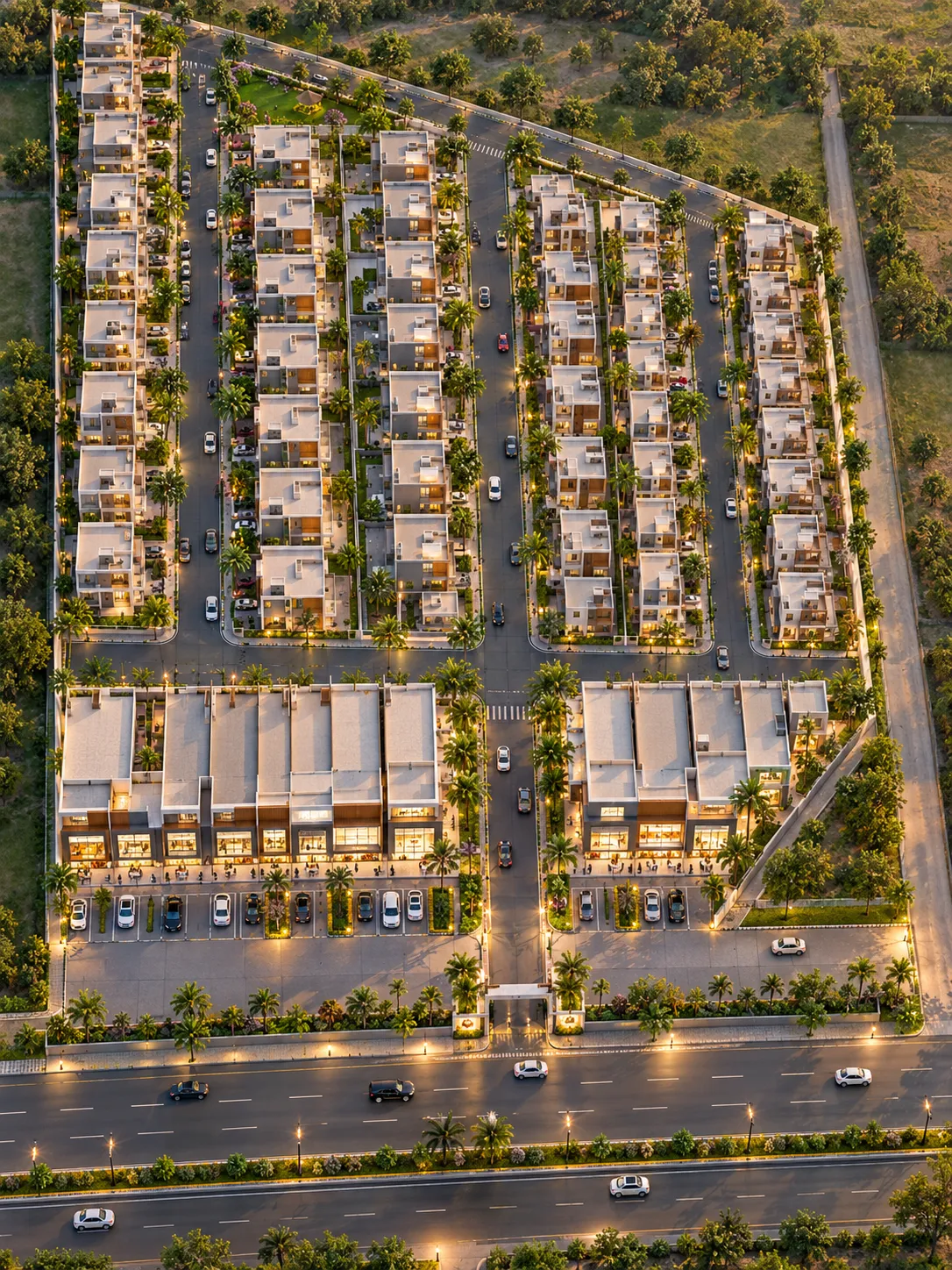 SITO MAJRA • KALKA
Planning Highlights
- Subdivision Layout The source document is explicitly titled a proposed sub-division plan of Durga Colony.
- 15–25 ft Road Network Multiple internal road widths (15 ft, 20 ft and 25 ft) structure vehicular circulation throughout the site.
- Green & Open Areas The supplied plan includes a clearly designated Green Area along with frontage open-area zones.
A Structured Subdivision Layout with Defined Road Access
Durga Colony is identified in the supplied project documentation as a subdivision development at Village Sito Majra, Tehsil Kalka, District Panchkula, Haryana. The plan separates proposed-building parcels from existing-building blocks and organises the site through a hierarchy of internal roads.
The supplied drawing identifies 15-ft, 20-ft and 25-ft road sections, a dedicated Green Area, boundary treatment and additional site-development references. The plan also shows directional road access toward Pinjore and Baddi along the front corridor.
The technical drawing communicates parcel subdivision, frontage alignment and circulation without publishing an aggregate project area or speculative unit sales inventory, providing verified clarity for portfolio exploration.
Understand the Layout Clearly
Explore the supplied Durga Colony subdivision plan showing proposed and existing building blocks, internal road widths, green/open areas and frontage connections toward Pinjore and Baddi.
Plan at a Glance
Official specifications transcribed directly from the architectural drawing:
| Planning Detail | Source Information |
|---|---|
| Project Name | Durga Colony |
| Village | Sito Majra |
| Tehsil | Kalka |
| District | Panchkula, Haryana |
| Road Widths | 15 ft / 20 ft / 25 ft shown |
| Green Area | Shown in Plan |
| Proposed Buildings | Shown in Plan Legend |
| Existing Buildings | Shown in Plan Legend |
| Boundary Wall | Identified in Legend |
| S.T. & R.W.H.T. | Identified in Legend |
| Directional Context | To Pinjore / To Baddi |
Proposed and Existing Building Layout
The supplied drawing distinguishes proposed-building parcels from existing-building blocks using separate colours. The proposed portion is organised into several numbered groups, while existing-building blocks are shown separately toward the frontage. Because the numbering restarts between portions of the plan, a single total property count should not be published until MBI confirms the final inventory structure:
Road Access and Parking Within the Layout
The supplied layout organizes internal movement through a multi-tiered hierarchy of 15-ft, 20-ft and 25-ft roads, alongside external directional links connecting toward Pinjore and Baddi:
15-ft Roads
Secondary access corridors designated within the narrower upper right sections of the subdivision plan.
20-ft Roads
Repeated internal road network coordinating primary circulation throughout the residential parcels.
25-ft Roads
Wider main internal thoroughfares coordinating entry and central parcel connectivity across the site.
Pinjore ↔ Baddi
Frontage roadway displays explicit directional alignments pointing toward Pinjore and Baddi.
Site Planning Visible in the Layout
The Durga Colony subdivision plan identifies building categories, road circulation, boundary treatment, green/open areas and additional technical site references. These reflect plan-identified provisions visibly designated in the drawing:
Boundary & Green Spaces
- Boundary Wall treatment identified explicitly in the plan legend.
- Dedicated Green Area parcel designated within the subdivision.
- Open area notations (including labelled 8'0" verandah strips and open frontage zones).
Technical Provisions & Context
- S.T. and R.W.H.T. provision identified in the source plan legend.
- Sewer reference annotated along the site boundary context.
- Structured 15-ft, 20-ft and 25-ft internal road corridors.
* The items above reflect site-planning provisions designated in the supplied subdivision drawing. Operational status and specific civic utility connections are subject to independent verification.
Located at Village Sito Majra, Kalka
The supplied Durga Colony subdivision plan identifies the site at Village Sito Majra, Tehsil Kalka, District Panchkula, Haryana. The frontage and access context illustrated in the technical drawing incorporates direct travel headings connecting toward Pinjore and Baddi.
Note: Road directions reflect alignment text recorded on the project drawing. Exact postal coordinates, driving times, and Google Maps pins should be verified independently prior to visiting.
Available Project Documentation
Looking for Information About Durga Colony?
This development is presented as part of MBI's completed project portfolio. If you require project-related information or technical layout clarifications, submit an enquiry and select Durga Colony so your request can be reviewed in the correct project context.
Current resale or other availability, if any, is subject to independent property ownership and formal verification.