Bharog Site
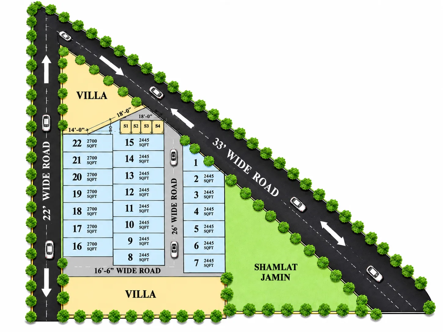
A completed MBI development planned with 22 plots, four shop units, dedicated parking and a defined road network, as documented in the supplied project layout.
View Site Plan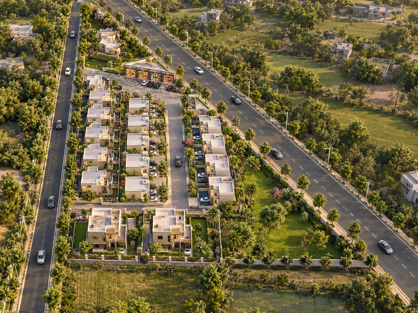 22 PLOTS • 4 SHOPS
Planning Highlights
- 22 Plots Twenty-two numbered plots arranged within the surveyed development layout.
- 4 Shop Units The project area chart records four shop units with a combined footprint of 494.9 sq ft.
- Structured Road Network The drawing identifies roads of different widths serving and adjoining the layout.
A Planned Layout Combining Plots, Shops and Road Access
Bharog Site is presented in the supplied project plan as a completed MBI development comprising 22 numbered plots and four shop units. The accompanying area chart records 28,049.6 sq ft of plot area and 494.9 sq ft of shop area.
The plan also records 7,254.3 sq ft used by roads and 448 sq ft allocated for parking, while showing a road network of different widths around and within the plotted layout. The drawing provides useful information about the site's organisation without separately stating an overall project-area total.
Understand the Layout Clearly
Explore the supplied Bharog layout showing the 22 numbered plots, shop component, internal and adjoining roads, parking area and the project's recorded area distribution.
Recorded Area Distribution
Official values transcribed directly from the drawing's area chart (22 Plots • 4 Shops):
| Source Category | Recorded Area |
|---|---|
| Area of Plots | 28,049.6 sq ft |
| Area of Shops | 494.9 sq ft |
| Area for Parking | 448.0 sq ft |
| Area Used by Roads | 7,254.3 sq ft |
Plot and Shop Layout
The supplied plan identifies 22 numbered plots and four shop units. Several recurring plot dimensions are clearly visible in the drawing, while the corner plots use different or irregular geometry:
Road Access and Parking Within the Layout
The plan identifies a hierarchy of 16'6", 22', 26' and 33' roads in and around the plotted layout, with the source area chart recording 7,254.3 sq ft as area used by roads:
33-ft Road
Prominent diagonal road corridor fronting the entrance units, shop block, and parking zone.
26-ft Road
Central internal circulation spine coordinating vehicle movement between the primary plot rows.
22-ft & 16'6" Roads
Secondary access routes recorded along outer boundaries and internal plot demarcations.
448 sq ft Parking
Dedicated parking area designated within the site schedule adjoining the shop and entry corridor.
Site Planning Visible in the Layout
The supplied Bharog plan primarily documents plots, shop area, road circulation, parking and adjoining land context. It does not include a separate schedule for utilities or project amenities, so this section focuses on elements clearly visible in the plan:
Layout & Circulation
- 22 numbered plots systematically organised around primary access paths.
- Multiple road widths (33', 26', 22', and 16'6") establishing internal and peripheral circulation.
- Dedicated 448.0 sq ft parking area planned along the frontage approach.
Commercial & Environmental Indicators
- Four commercial shop units totalling 494.9 sq ft arranged strategically at entry frontage.
- Landscape and tree indicators illustrated across internal streets and boundary demarcations.
* The items above reflect site-planning features visibly designated on the supplied layout drawing. Operational status and specific civic utility provisions are subject to independent verification.
Available Project Documentation
Looking for Information About Bharog Site?
This development is presented as part of MBI's completed project portfolio. If you require project-related information or technical layout clarifications, submit an enquiry and select Bharog Site so your request can be reviewed in the correct project context.
Current resale or other availability, if any, is subject to independent property ownership and formal verification.