MBI Maa Bala Sundri-04
- Katthe Majra Site
A completed MBI plotted development covering 65,428 sq ft, planned around 48 residential plots, a structured 22-ft-wide internal road network and supporting site-development provisions documented in the supplied project plan.
View Site Plan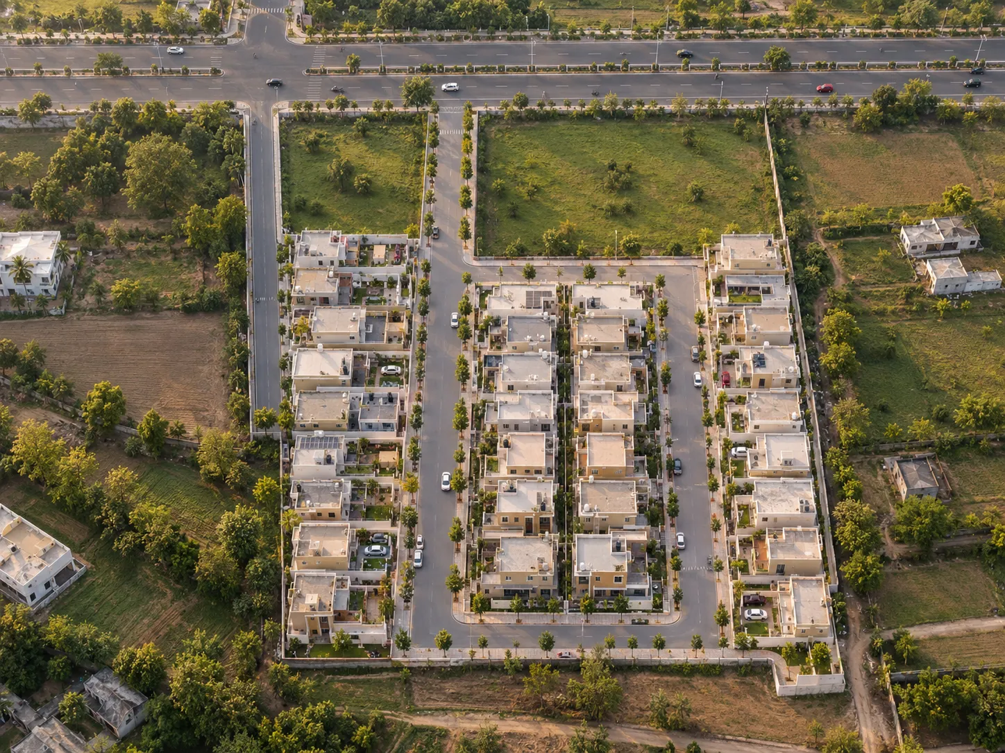 48 RESIDENTIAL PLOTS
Planning Highlights
- 48 Residential Plots Forty-eight residential plots are explicitly recorded in the source area chart.
- 22-ft Internal Roads Multiple internal road corridors are labelled 22 ft wide throughout the layout.
- 18,381 sq ft Road & Parking The source separately records a combined road and parking circulation allocation.
A Structured Residential Plot Layout with Defined Internal Roads
MBI Maa Bala Sundri-04 - Katthe Majra Site is presented in the supplied project plan as a completed plotted development comprising 48 residential plots across a total recorded area of 65,428 sq ft.
The source area chart records 47,074 sq ft as residential plot area and 18,381 sq ft collectively as road-and-parking area. The development is organised through several 22-ft-wide internal road corridors connecting multiple plot blocks to the main road frontage.
The project plan also contains a dedicated work legend identifying boundary, water-supply, sewerage and electrical provisions, including a 3 HP submersible, fresh water tank, sewerage pipeline, water-supply pipelines, and electricity pole and transformer.
Understand the Layout Clearly
Explore the supplied Maa Bala Sundri-04 plan showing the 48 residential plots, repeated 22-ft-wide internal roads, main-road frontage, surrounding land context and project infrastructure legend.
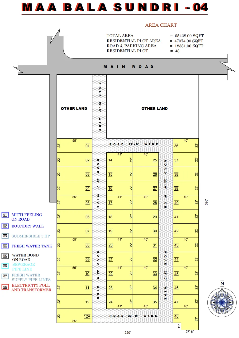
Recorded Area Distribution
Official values transcribed directly from the drawing's area chart:
| Source Category | Recorded Metric |
|---|---|
| Total Project Area | 65,428 sq ft |
| Residential Plot Area | 47,074 sq ft |
| Road & Parking Area | 18,381 sq ft |
| Residential Plots | 48 Plots |
Residential Plot Layout
The supplied project plan contains 48 residential plots arranged across three main blocks. Many regular plots use a 22-ft depth/frontage reference with widths around 40–55 ft depending on block position, while several end and corner plots have different dimensions:
Road Access and Parking Within the Layout
The supplied layout allocates 18,381 sq ft collectively to roads and parking, with a consistent network of 22-ft internal roads and direct access onto the frontage Main Road:
18,381 sq ft Area
Substantial combined area allocated collectively in the source area chart for internal access roadways and vehicle parking.
22-ft Roads
Primary internal circulation network with repeated 22-ft-wide north-south and cross-connecting thoroughfares.
Internal Corridors
Multiple internal corridors coordinating direct vehicular and pedestrian connectivity across all three plotted blocks.
Main Road Frontage
External thoroughfare access connecting the northern perimeter entry points directly into the regional road network.
Infrastructure Identified in the Project Plan
The supplied Maa Bala Sundri-04 plan includes a project-specific work legend identifying road preparation, boundary treatment, water-supply infrastructure, sewerage and electrical provisions:
Road & Boundary Works
- Boundary wall construction around surveyed layout perimeter.
- Road filling / earthwork preparation (source: Mitti Feeling on Road).
- Road-treatment specification (source: Water Bond on Road).
- 18,381 sq ft combined road and parking circulation network.
Water & Sewer Infrastructure
- Submersible pump provision (3 HP capacity).
- Fresh water storage tank installation.
- Fresh water supply pipeline network across blocks.
- Underground sewerage pipeline infrastructure.
Electrical Infrastructure & Power Distribution
- Dedicated on-site electrical transformer unit.
- Electricity distribution poles grid (source: Electricity Poll and Transformer).
* The items above reflect site-planning provisions designated in the supplied project legend. Operational status and specific civic utility connections are subject to independent verification.
Maa Bala Sundri-04 - Katthe Majra Site
This project is identified in the supplied MBI file set as the Katthe Majra Site (drawing title: MAA BALA SUNDRI -04). The technical plan shows vehicular access from an adjoining Main Road along the northern perimeter boundary.
Note: Road references reflect alignment text recorded on the technical drawing. Exact postal coordinates, driving times, and Google Maps links should be verified independently prior to site visits.
View Project Information
Looking for Information About Maa Bala Sundri-04?
This development is presented as part of MBI's completed project portfolio. If you require project-related information or technical layout clarifications, submit an enquiry and select MBI Maa Bala Sundri-04 - Katthe Majra Site so your request can be reviewed in the correct project context.
Current resale or other availability, if any, is subject to independent property ownership and formal verification.